Scanfly EVO: the mobile mapping LiDAR for drone, backpack and vehicle
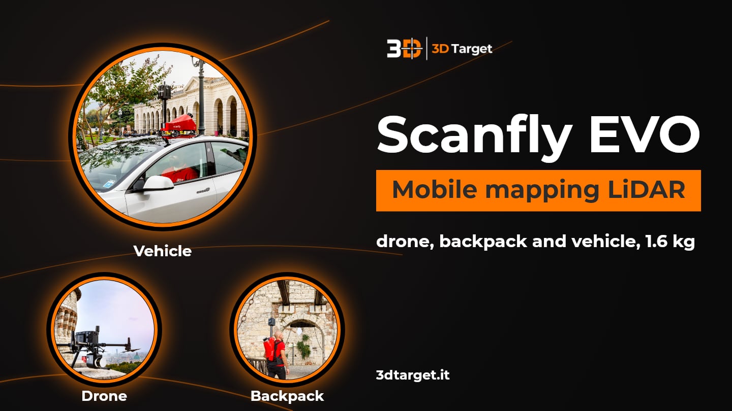
If you need a mobile mapping LiDAR to use in flight, on foot and on a vehicle, Scanfly EVO is the system to know. It is the 3DT multi-platform LiDAR: it weighs 1.6 kg, is cable-free, captures up to 1,280,000 points per second with a range of 130 m and offers 3 cm precision and accuracy.
On this page we explain how it is built, how it mounts on the drone, the backpack and the car, what the numbers mean and which software you need to get to the point cloud. The data is as declared by 3DT: for configuration, accessories and prices, 3D Target is at your disposal.
Talk to one of our technicians
Scanfly EVO at a glance
| Feature | Data declared by 3DT |
|---|---|
| Platforms | Airborne (drone with DJI Skyport mount), on foot with the backpack, on vehicle |
| Weight and dimensions | 1.6 kg; 181 × 133 × 142 mm |
| Scanning speed | Up to 1,280,000 points/s |
| Maximum range | 130 m; recommended flight height 15-85 m above ground |
| Precision and accuracy | 3 cm (RMS 1σ measured at 50 m, PPK with open-sky GNSS) |
| LiDAR head | 32-channel multichannel, 5-20 Hz, 905 nm laser; range: 10 mm accuracy, 5 mm precision |
| Positioning | Survey grade inertial navigation (200 Hz IMU, 1 kHz internal); 336-channel GNSS, GPS, GLONASS, BeiDou, Galileo, QZSS, SBAS, PPK mode |
| Data and connections | 256 GB removable external USB 3.2 flash drive; integrated WiFi; 56-pin multi I/O interface |
| Power | 12-24 V, max 30 W; USB Power Delivery 2.0 (USB-C port) |
| Protection and temperature | IP65 / CE when installed in a 3DT mounting kit; from -10 °C to +40 °C |
| Software | Scanfly WebApp and SmartProcessing Lidar included; SmartSurvey for Windows sold separately |
Mounting kits and RGB cameras are not included and are sold separately. The 3 cm precision is measured by 3DT at a distance of 50 m, in PPK post-processing with open-sky GNSS: in different conditions the result may vary.
One system for drone, backpack and vehicle
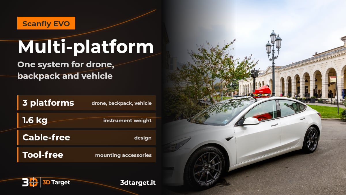
With Scanfly EVO the same instrument works on the drone, on your back with the backpack or on board a vehicle. Instead of having a different sensor for each type of survey, you only change the mounting kit.
Airborne: with the 3DT-SF-v3-SKY adapter it attaches to drones with a DJI Skyport mount. The recommended flight height is between 15 and 85 m above ground.
On foot: with the backpack kit it is carried on your back and the survey is done while walking.
On vehicle: with the 3DT-SF-v3-LMK kit it mounts on the car and surveys the route as you drive.
Cable-free and tool-free: the design is cable-free and the mounting accessories attach without tools.
Ask for a consultation on Scanfly EVO
Performance: points per second, range and precision
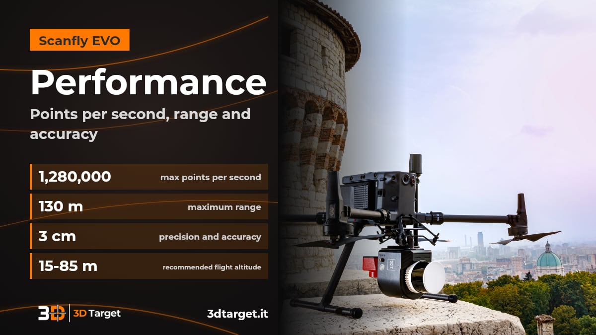
Scanfly EVO captures up to 1,280,000 points per second, with a maximum range of 130 m and 3 cm precision and accuracy. These are the numbers that determine how dense the point cloud is and how far you can trust the data.
LiDAR head: 32-channel multichannel, rotating at 5 to 20 Hz, with a 905 nm laser.
Distance measurement: 10 mm accuracy and 5 mm precision.
Survey precision: 3 cm precision and 3 cm accuracy, as RMS 1σ at 50 m in PPK with open-sky GNSS.
Position and attitude: survey grade inertial navigation system with a 200 Hz IMU (1 kHz internal rate) and a 336-channel multi-constellation GNSS receiver, in PPK mode.
Mounting kits and RGB cameras
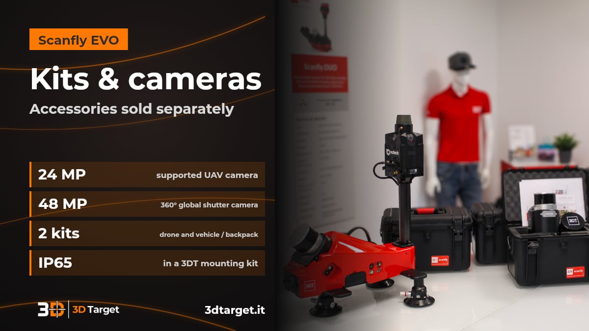
Scanfly EVO adapts to the survey with two mounting kits and two supported RGB cameras, all sold separately. You build the system according to where and how you need to survey.
3DT-SF-v3-SKY: adapter for drones with a DJI Skyport mount.
3DT-SF-v3-LMK: kit for vehicle mounting and for the backpack. When installed in a 3DT mounting kit, the system has IP65 protection and CE marking.
24 MP UAV camera: to add images to the LiDAR data.
360° global shutter panoramic camera, 48 MP: 4 x 12 MP cameras that generate 32 MP panoramic images. The multi-sensor interface handles camera triggering.
Control, data and software
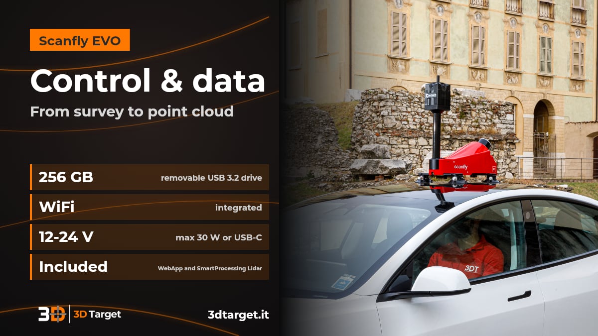
Scanfly EVO is controlled with a touch button and from the Scanfly WebApp; the data is processed with SmartProcessing Lidar, included. The workflow is continuous, from acquisition to the point cloud.
Control: capacitive touch button on the instrument, Scanfly WebApp included and integrated WiFi. SmartSurvey for Windows, sold separately, is used to configure the system and to control the acquisition in real time from a PC.
Data: saved to a 256 GB removable external USB 3.2 flash drive.
Power: from 12 to 24 V (max 30 W) or from the USB-C port with USB Power Delivery 2.0.
Processing: SmartProcessing Lidar generates point clouds in a few clicks, supports SLAM and includes the GCP and Strip Alignment and Image blurring tools.
Scanfly EVO or Scanfly PRO?
In the same family there is Scanfly PRO: the same multi-platform format, but with a dual GNSS receiver, up to 1,920,000 points/s, 300 m range and 2 cm precision, also designed for challenging GNSS environments such as tunnels and dense urban areas. You will find the data on the Scanfly PRO product page; we can help you choose between the two.
The other instruments are in the laser scanner catalog and in the mobile mapping section.
With 3D Target you are not alone in the field
Consulting: we help you understand whether Scanfly EVO is right for your type of survey and which configuration you need.
Trial and demonstration: ask us to see the system in action.
Training: to use the instrument and the software.
Support: technical support after purchase.
Integration: our R&D department works on custom solutions.
Discover all 3D Target services and the Scanfly EVO product page. For the official specifications you can also see the Scanfly EVO page on scanfly.it.
Frequently asked questions
What is Scanfly EVO?
It is the 3DT multi-platform mobile mapping LiDAR system. It weighs 1.6 kg, is cable-free and is used airborne on drones with a DJI Skyport mount, on foot with the backpack and on vehicle.
How many points per second does it capture and what is the range?
Up to 1,280,000 points per second, with a maximum range of 130 m. In flight, the recommended height is between 15 and 85 m above ground.
How accurate is Scanfly EVO?
3 cm precision and accuracy, measured as RMS 1σ at a distance of 50 m, in PPK with open-sky GNSS. The LiDAR head measures distance with an accuracy of 10 mm and a precision of 5 mm.
Are mounting kits and cameras included?
No. The 3DT-SF-v3-SKY drone kit, the 3DT-SF-v3-LMK vehicle and backpack kit, the 24 MP UAV camera and the 48 MP panoramic camera are sold separately.
What software is needed?
Scanfly WebApp and SmartProcessing Lidar are included: the first controls the instrument, the second processes the data and generates the point cloud. SmartSurvey for Windows, to configure and control the acquisition in real time from a PC, is sold separately.
How much does it cost and how do I order it?
We work on a quotation basis. Write to info@3dtarget.it or call +39 030 5357677, or use the contact page.
Do you have a survey to plan?
Tell us what you need to survey, where and with which platform: we will tell you whether Scanfly EVO is the right solution and how to get started.
The technical data is as declared by 3DT in the datasheet and on the scanfly.it website and may vary. For up-to-date data, ask us for confirmation. DJI and Skyport are trademarks of their respective owners.