Scanfly PRO: Mobile Mapping LiDAR with Dual GNSS | 3D TARGET
search
  • Scanfly PRO: Mobile Mapping LiDAR with Dual GNSS | 3D TARGET
  • Scanfly PRO: Mobile Mapping LiDAR with Dual GNSS | 3D TARGET
  • Scanfly PRO: Mobile Mapping LiDAR with Dual GNSS | 3D TARGET
  • Scanfly PRO: Mobile Mapping LiDAR with Dual GNSS | 3D TARGET
  • Scanfly PRO: Mobile Mapping LiDAR with Dual GNSS | 3D TARGET

Scanfly PRO

Reference: 3DT-SF-v3-PRO

Scanfly PRO is the 3DT multi-platform mobile mapping LiDAR system that takes performance to the highest level: dual GNSS receiver to work even in difficult GNSS environments, up to 1,920,000 points/s with a range of 300 m and a precision of 2 cm, at just 1.4 kg.

Price on request

Open contact form
close

Domanda prodotto

 
Scanfly PRO

Scanfly PRO

€0.00

DescriptionScanfly PRO: the mobile LiDAR for accurate surveys even where GNSS is difficult, up to 1,920,000 points per second, 300 m of range in just 1.4 kg

Accuracy even where GNSS is difficult

Scanfly PRO takes performance to the highest level. With the dual GNSS receiver and the survey grade inertial navigation system it maintains uncompromising accuracy even in difficult GNSS environments, such as tunnels and dense urban areas.

One system, three ways to survey

The same instrument works on a drone, on your back with the backpack or on board a vehicle. The design is cable-free and the accessories mount without tools: with the DJI Skyport adapter it flies on the drone, with the vehicle and backpack kit it surveys on the road or on foot. All in just 1.4 kg.

More points, more range

Scanfly PRO captures up to 1,920,000 points per second with a maximum range of 300 m, with a recommended flight altitude of 15 to 210 m above ground. The 2 cm precision and accuracy (RMS 1σ at 50 m, in PPK with open-sky GNSS) provide reliable data for technical work.

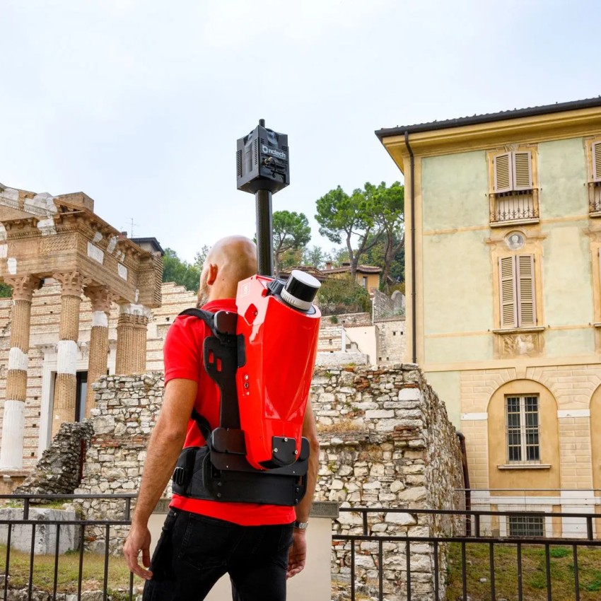
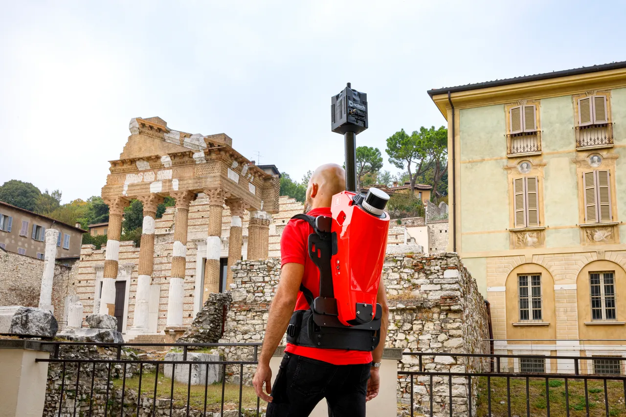
Operator carrying Scanfly PRO in backpack configuration among the ruins of an archaeological site
Scanfly PRO mounted on a car roof in a square with arcades
Survey and positioning performance

Scanning speed and range

The Scanfly PRO LiDAR head has 32 channels, rotates at 5 to 20 Hz and captures up to 1,920,000 points/s, with a maximum range of 300 m. In flight, the recommended height is from 15 to 210 m above ground. The laser has a wavelength of 905 nm.

Precision and accuracy

For those who must deliver technical surveys, being able to trust the data matters. Scanfly PRO offers 2 cm precision and accuracy, measured as RMS 1σ at a distance of 50 m in PPK post-processing with open-sky GNSS. The LiDAR head measures distance with an accuracy of 10 mm and a precision of 5 mm.

Dual GNSS and inertial navigation

Scanfly PRO has a dual GNSS receiver (2 × 336 channels) that works with GPS, GLONASS, BeiDou, Galileo, QZSS and SBAS in PPK mode. It also features a survey grade inertial navigation system with a 200 Hz IMU (1 kHz internal rate). Scanfly PRO is designed to deliver uncompromising accuracy even in challenging GNSS environments.

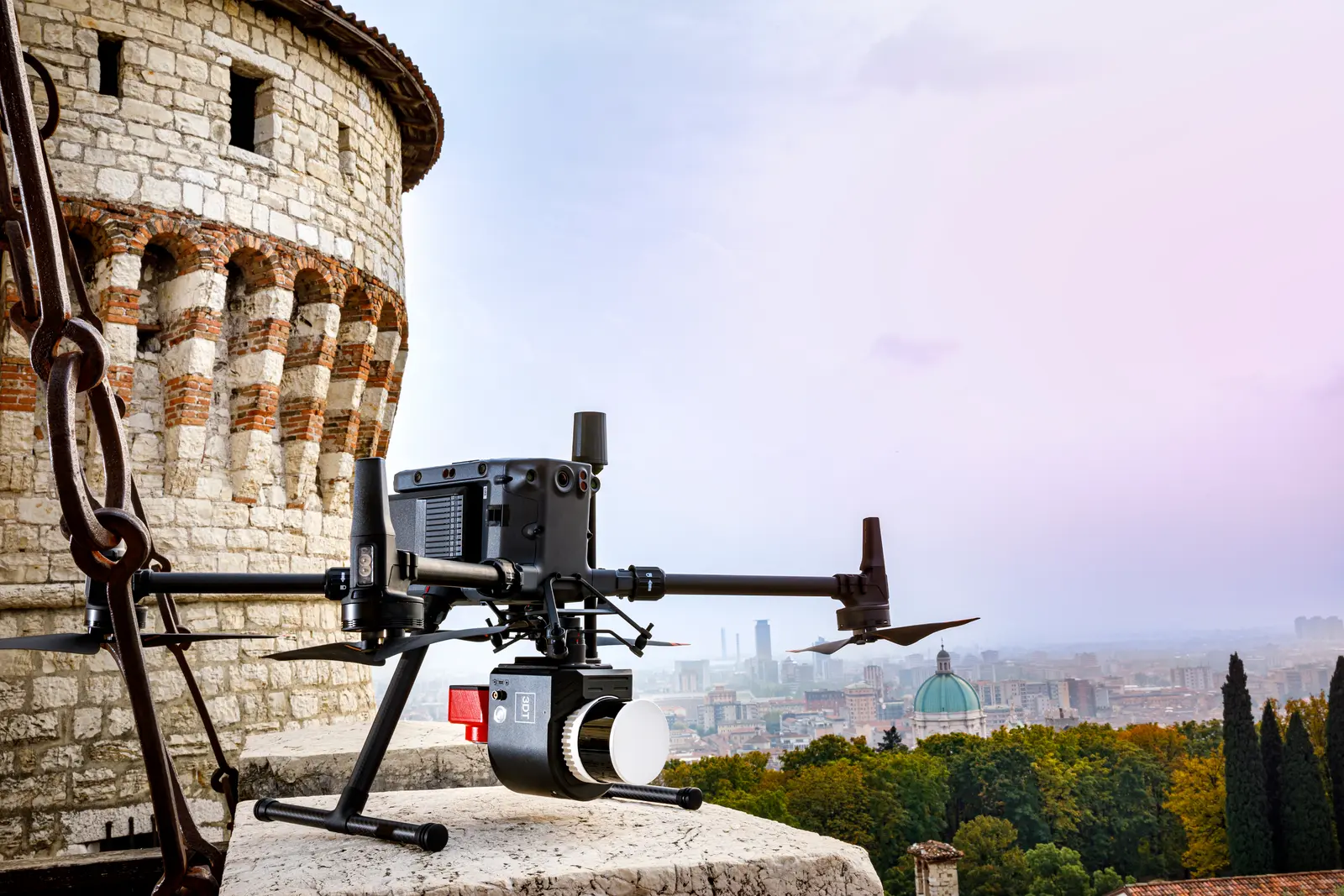
Drone with Scanfly PRO on the walls of a castle, with the city in the background
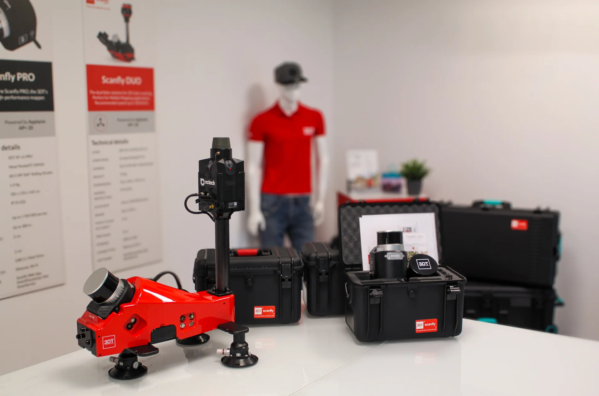
Scanfly PRO with carry cases, mounting kit and panoramic camera
Mounting kits and cameras

Scanfly PRO adapts to the type of survey with dedicated mounting kits and RGB cameras, all sold separately.

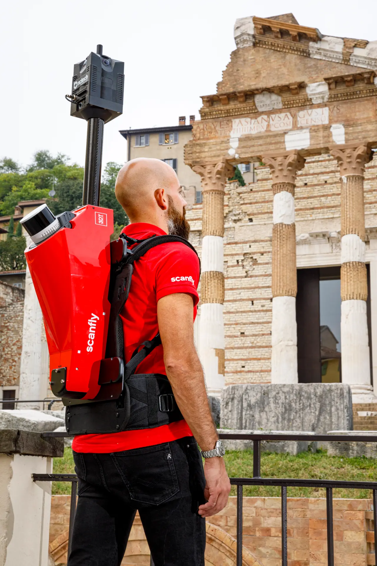
The 3DT-SF-v3-LMK kit lets you mount Scanfly PRO on a vehicle or carry it on your back with the backpack. This way the same sensor surveys both from the car and on foot. When installed in a 3DT kit, the system has IP65 protection and CE marking.

With the 3DT-SF-v3-SKY adapter, Scanfly PRO attaches to drones with a DJI Skyport mount and becomes an aerial survey system. In flight, the recommended height above ground is between 15 and 210 m, with a maximum range of 300 m and up to 1,920,000 points/s.

To add color and images to the LiDAR data, Scanfly PRO supports a 24 MP UAV camera and a 360° global shutter panoramic camera, 48 MP, made up of 4 x 12 MP cameras that generate 32 MP panoramic images. The multi-sensor interface handles camera triggering. The cameras are sold separately.

Control, data and power

The survey starts with a touch

Simple, cable-free control

Starting a survey must be immediate, even in the field. Scanfly PRO is controlled with the capacitive touch button on the instrument and with the included Scanfly WebApp, and it has integrated WiFi. To configure and follow the acquisition in real time from a PC there is SmartSurvey for Windows, sold separately.


Data and power

Data is saved to a removable 256 GB external USB 3.2 flash drive. Power is supplied through the USB-C port with USB Power Delivery 2.0 or from a 12-24 V source (max 30 W). The 56-pin multi I/O interface carries power, Ethernet, camera trigger/strobe and GNSS.

Car with Scanfly PRO mounted on the roof

Even in tunnels
and dense urban areas

Scanfly PRO combines a multichannel LiDAR head, survey grade inertial navigation and a dual GNSS receiver in 1.4 kg, cable-free. A single system to survey from the drone, the backpack or the car, even where the satellite signal is difficult, with a continuous workflow all the way to the point cloud.

One system for every type of survey

With the backpack kit, Scanfly PRO is carried on the operator's back and the survey is done on foot, even in dense urban areas. The sensor weighs only 1.4 kg and the touch button and the Scanfly WebApp allow the acquisition to be managed.
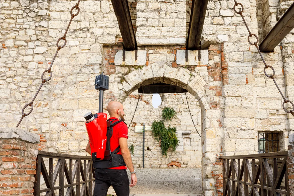
Operator carrying Scanfly PRO as a backpack in front of a castle gate

With the 3DT-SF-v3-SKY adapter, Scanfly PRO mounts on drones with a DJI Skyport mount. The recommended flight height is from 15 to 210 m, with a maximum range of 300 m and up to 1,920,000 points/s. The supported RGB cameras, sold separately, add images to the LiDAR data.
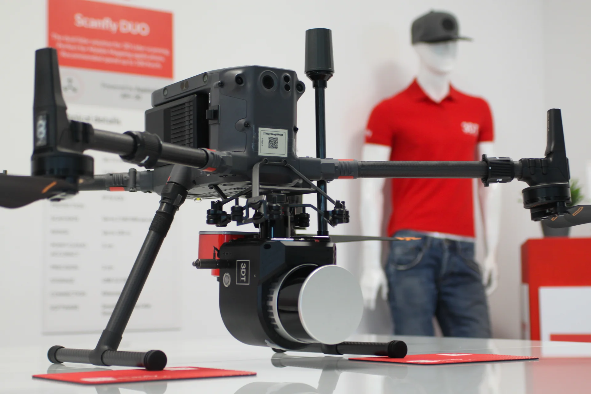
Drone with Scanfly PRO mounted underneath, on display

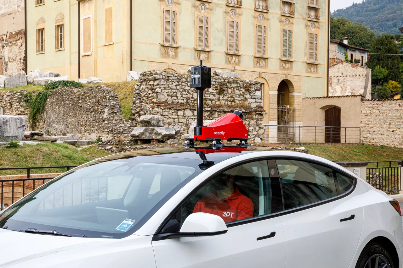
On the roof of the car, with the 3DT-SF-v3-LMK kit, Scanfly PRO surveys the route as you drive, capturing up to 1,920,000 points/s. The dual GNSS receiver makes it suitable for tunnels and dense urban areas too, and the supported RGB cameras, sold separately, add images.

Scanfly PRO on a car roof in front of a building with arcades

The Scanfly PRO mounting accessories attach without tools and the system is cable-free. When installed in a 3DT mounting kit it has IP65 protection and CE marking, and works from -10 °C to +40 °C.
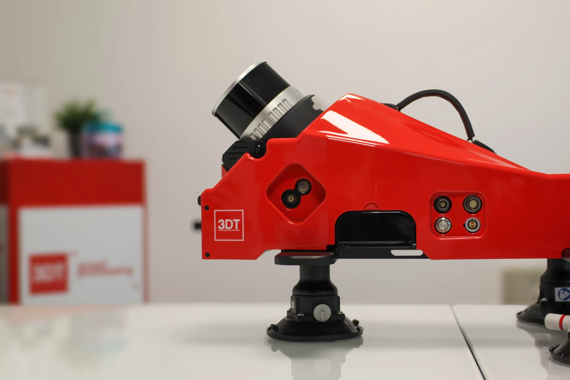
Scanfly PRO on its mounting base, side view

The heart of Scanfly PRO is a 32-channel LiDAR head with a 905 nm laser, rotating at 5 to 20 Hz and reaching a range of 300 m. It measures distance with an accuracy of 10 mm and a precision of 5 mm, for dense and reliable point clouds.
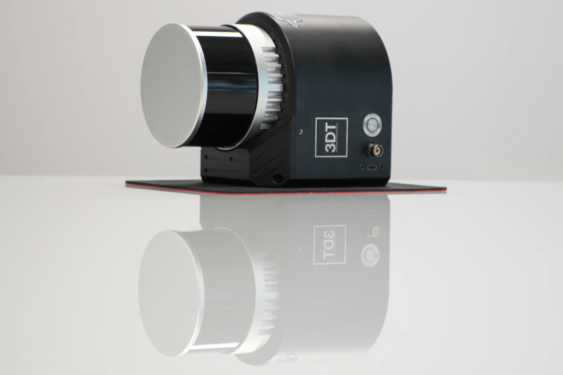
Scanfly PRO module with LiDAR head, close-up view

Car with Scanfly PRO on the roof and operator on board
Software and data processing

Scanfly WebApp and SmartSurvey

The Scanfly WebApp, integrated in the system and included, lets you control the instrument, which also has integrated WiFi. For those who prefer to work from a PC, SmartSurvey for Windows is used to configure the system and to control the acquisition in real time. SmartSurvey is sold separately.

SmartProcessing Lidar

After the survey, SmartProcessing Lidar processes the Scanfly PRO data and generates point clouds in a few clicks, with a continuous workflow from acquisition to the final result. SmartProcessing Lidar is included with Scanfly PRO; for the analysis of mobile mapping data there is also SmartProcessing.

SLAM, GCP and Strip Alignment

SmartProcessing Lidar supports SLAM and includes the GCP and Strip Alignment tool, as well as the image blurring tool for images. These are the tools through which the data captured by Scanfly PRO becomes the final point cloud.

Frequently asked questions about Scanfly PRO

What is the difference between Scanfly PRO and Scanfly EVO?

Scanfly PRO is the higher-performance version: it has the dual GNSS receiver (2 × 336 channels), captures up to 1,920,000 points/s versus 1,280,000, has a range of 300 m versus 130 m, 2 cm precision and accuracy versus 3 cm, and weighs 1.4 kg versus 1.6 kg. It is also designed for difficult GNSS environments, such as tunnels and dense urban areas.

Scanfly PRO is a multi-platform system: it is used airborne on drones with a DJI Skyport mount, on foot with the backpack and on a vehicle. The 3DT-SF-v3-SKY and 3DT-SF-v3-LMK mounting kits are sold separately.

Scanfly PRO captures up to 1,920,000 points per second with a maximum range of 300 m. In flight, the recommended height is between 15 and 210 m above ground.

Scanfly PRO has 2 cm precision and accuracy, measured as RMS 1σ at a distance of 50 m, in PPK with open-sky GNSS. The LiDAR head measures distance with an accuracy of 10 mm and a precision of 5 mm.

Scanfly PRO supports a 24 MP UAV camera and a 360° global shutter panoramic camera, 48 MP, with 4 x 12 MP cameras that generate 32 MP panoramic images. The cameras are sold separately.

Scanfly PRO is controlled with the capacitive touch button, with the included Scanfly WebApp, and with SmartSurvey for Windows, sold separately. Data is saved to a removable 256 GB external USB 3.2 flash drive.

The data is processed with SmartProcessing Lidar, included with Scanfly PRO, which supports SLAM and includes the GCP and Strip Alignment and Image blurring tools.

The 3D TARGET technical and sales team offers a free consultation to recommend the configuration best suited to your operational needs. Use the Request more information button on this page.

Application scenarios

Car with Scanfly PRO on the roof in front of an archaeological site

Discover how Scanfly PRO can revolutionize your workflows

Aerial surveys with drone | Mobile mapping on a vehicle | On-foot surveys with the backpack

Our technical and sales team is ready to offer you a free consultation to discover Scanfly PRO and recommend the solution best suited to your operational needs. Contact the 3D TARGET experts.

Data sheet

Codice
3DT-SF-v3-PRO
Dimensioni
180×133×142 mm
Peso
1.4 kg
Tensione in entrata
12-24 V, max 30 W | USB Power Delivery 2.0 (USB-C port)
Tipo di rilevamento
32-channel multichannel LiDAR head | Rotation speed: 5-20 Hz | Range accuracy/precision: 10 mm / 5 mm
Ambiente operativo
Multi-platform: airborne, on foot (backpack) and on vehicle
Camera
Supported, not included: 24 MP UAV camera | 360° global shutter panoramic camera, 48 MP (4 x 12 MP cameras, 32 MP panoramic images)
Lunghezza d'onda del laser
905 nm
Aeromobili supportati
Drones with DJI Skyport mount, via the 3DT-SF-v3-SKY adapter (sold separately)
Funzioni extra
Survey grade inertial navigation system (200 Hz IMU, 1 kHz internal) | Cable-free design | Tool-free mounting accessories | Capacitive touch button | Carrying case
Frequenza GNSS
Dual GNSS receiver, 2 × 336 channels | GPS, GLONASS, BeiDou, Galileo, QZSS, SBAS | PPK mode
Temperatura operativa
From -10 °C to +40 °C
Grado di protezione IP
IP65 / CE (when installed in a 3DT mounting kit)
Velocità scansione
Up to 1,920,000 points/s
Portata
Maximum range: 300 m | Recommended flight height (AGL): 15-210 m
Precisione nuvola di punti
Precision: 2 cm | Accuracy: 2 cm (RMS 1σ, measured at 50 m, PPK in open-sky GNSS environment)
Spazio disco
256 GB removable external USB 3.2 flash drive
Connettività
Integrated WiFi | 56-pin multi I/O interface: power, Ethernet, camera trigger/strobe, GNSS
Software
Control: touch button, Scanfly WebApp, SmartSurvey (Windows) | Post-processing: SmartProcessing Lidar with SLAM, GCP and Strip Alignment, Image blurring | Scanfly WebApp and SmartProcessing Lidar included; SmartSurvey sold separately